Addressing Resource Management Concerns of the Indigenous Communities in. Palawan
Palawan is the long narrow island lying northeast-southwest of the Philippines. It is a province abundant in natural resources and is a popular haven for tourists. It is unique not only in its pristine environment, its richness in culture and the refuge it provides to wildlife, but also in the province-wide proactive call to preserve the source of its richness: the natural environment and its indigenous communities.
In 1992, the Strategic Environmental Plan for Palawan (SEP) under Republic Act 7611 came into being. The SEP is "a comprehensive framework for the sustainable development of Palawan, compatible with protecting and enhancing the natural resources and endangered environment of the province.... The SEP shall serve to guide the local government of Palawan and the government agencies concerned in the formulation and implementation of plans, progress and projects affecting said province."
The SEP implements as its primary strategy the establishment of a graded system of protection and development over the whole of Palawan, the Environmentally Critical Areas Network (ECAN). The ECAN is classified into three components: terrestrial (including the forest, mines and agricultural areas); coastal and marine areas (including small islands, mangroves, coral reefs, sea grass beds and the surrounding sea); and tribal ancestral lands.
In line with its functions, the Palawan Council for Sustainable Development (PCSD), that was mandated to govern, implement, and give policy direction to the SEP, formed committees to systematize the implementation of its policies across the three components. One of the committees formed was the Committee on Tribal Affairs (CTA).
In Palawan, the CTA provided an entry point for groups that were strongly advocating a policy of recognition, identification and delineation of ancestral domain claims. Such groups include the Nagkakaisang mga Tribu ng Palawan (NATRIPAL), Inc. or the United Tribes of Palawan, a provincewide federation of 52 local indigenous people's organizations; the Tanggapang Panligal ng Katutubong Pilipino (PANLIPI), a legal rights and legal services organization catering mainly to the indigenous communities; and the Tribal Filipino Apostolate (TFA), a church-base, non-government organization that pioneered the formation of the mass-based indigenous organization, the NATRIPAL.
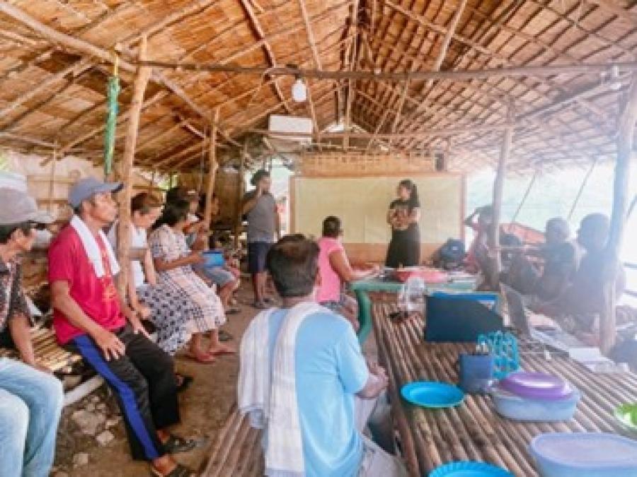
Together, they form a consortium bound by a common goal to develop and strengthen the capabilities of NATRIPAL and its member-organizations in managing community-based projects. These projects span key issues of land and resource rights, sustainable resource management, enterprise development and institutional or organizational capability-building. They are hinged on the premise that the granting of the Certificates of Ancestral Domain Claims (CADCs) shall serve as an incentive to indigenous communities to protect and sustainably utilize and manage the natural resources within their ancestral domains. These resources include those with economic value such as the non-timber forest products (NTFPs) including rattan, almaciga (resin), bamboo (boho), wild vines, honey and others. Land and Resource Rights of Indigenous Communities
In the Philippines, the indigenous struggle for recognition of their rights to their ancestral domain, and the resources found therein, dates back to the 300-year colonization of the Philippines by the Spanish Government. The disenfranchisement of the indigenous communities was spawned by the declaration of the Spanish Crown that all lands, by virtue of Ferdinand Magellan's supposed discovery of the Philippines, shall be owned and controlled by the State. This principle is known as the Regalian Doctrine which has since been adopted in the Philippine Constitution.
The enforcement of land registration laws by authority of this principle prejudiced the indigenous communities in their illiteracy and inability to comprehend the modern concept of public and private lands. As a result of their failure to comply with those requirements, the indigenous communities were dispossessed of their lands.
Under the present constitutional framework of the Philippines, the classification and determination of ownership and extent of ancestral domains, vis-_-vis applicability of custom laws governing property rights and management of natural resources within ancestral domains, still remains an issue.
Pending the passage of an ancestral domain bill, the Department of Environment and Natural Resources (DENR) issued an administrative order, providing for the delineation and survey of ancestral domain claims throughout the country. "Ancestral domain" refers to all lands and natural resources occupied or possessed by indigenous communities. It includes all adjacent areas generally belonging to them and which are necessary to ensure their economic, social and cultural welfare.
The administrative order outlines the rules and regulations relevant to the following: 1) procedures or steps for the identification and delineation of ancestral domains; 2) certification of ancestral domain claims; 3) provision for contracts, leases and permits within ancestral domains; 4) implementation of government programs within the ancestral domains; 5) safeguards against encroachment; 6) rights and responsibilities of the claimants; and 7) management of ancestral domains.
In 1993, the Palawan Council for Sustainable Development approved the administrative order as specific guidelines for the tribal ancestral lands component under the Strategic Environmental Plan for Palawan. The guidelines also provided for the formation of the Provincial Special Task Force on Ancestral Domain (PSTFAD) which serves as the highest body in the province to review, and endorse for subsequent approval of the Secretary of the DENR, all ancestral domain claims in the province. In lieu of the SEP, the PSTFAD includes the Chairman of the Committee on Tribal Affairs to represent the PCSD in the decision-making process, related to all ancestral domain claims issues in the province. Delineation of Ancestral Domain Claims
Since the formation of the PSTFAD in Palawan, the group has not been cohesive enough, being divided in terms of priorities, interests, work dynamics and culture. There has also been a lack of common understanding and interpretation of the rules and regulations, provided for the identification, delineation and recognition of ancestral domain claims.
Based on the fundamental assumption that the community will ultimately own the ancestral domain and will implement the domain management plan, the involvement of the community in the delineation process is very crucial.
Unfortunately, in the first delineation experiences of the PSTFAD in Palawan, the group failed to enable the communities to fully understand not only the opportunities associated with the process but the limitations as well. Nonetheless, the serious efforts of assisting organizations in information dissemination and awareness-building cannot be discounted.
Although the CADC is not a title, it can already serve as a strong basis for the protection of the tenure of the community claimant, in the land that they have long possessed and occupied. The recognized claimant community is given the power to manage the land and the corresponding natural resources, based on the domain management plan formulated by them and approved by the DENR. Boundary Issue and Negotiation with Competing Land Users
To date, there are 14 CADC applications pending with the PSTFAD. The corresponding areas do not necessarily represent 14 barangays or municipalities. Rather, they are a mix of individual sitio/barangay claims, and contiguous barangay claims. Municipalities are made up of a number of barangays or local administrative units. Barangays, in turn, can comprise several sitios or smaller villages or communities.
Out of 14, three sites have already been delineated, and surveyed. Two of the sites, Bgy. Cabayugan (5,091.75 ha.) and Sitio Kayasan (7,530.295 ha.) in Bgy. Tagabinit, Puerto Princesa City, are located in the buffer zone area of the 5,753 ha. St. Paul Subterranean River National Park.
The contiguous claim in Southern Palawan covers four barangays (Bgys. Amas, Mainit, Imunlod and Aribungos, Municipality of Brooke's Point) with a total area of 14,551.57 ha. While the experience of the PSTFAD with the local government unit had been quite congenial in Brooker's Point, the same cannot be said in the Municipality of Rizal. What started out as a very hopeful process in 1993 for the 11-barangay ancestral domain USAID-funded DENR pilot project in Rizal was marred by the failure of the PSTFAD to collectively manage the conflict between the different competing land users in the area.
Various interests in the claim of the Palawan community in Rizal, including the 600 ha. site proposed for the World Bank-funded coconut seed garden project of the Philippine Coconut Authority (PCA), illustrate a scenario where the indigenous community and other stake-holders, in this case the local government unit, and the assisting organizations such as NATRIPAL, TFA and PANLIPI have conflicting opinions about the claim in relation to the proposed project.
It took a report from PANLIPI on the alleged signing of some members of the community, of waiver of rights over their occupied lands covering the area of the proposed ancestral domain claim in one of the barangays in Rizal, for field validation and evaluation to be conducted to the proposed project.
Earlier, the local government unit of Rizal already gave their full endorsement of the project as it allowed additional revenues for the municipality and the economic uplifting of the local and indigenous community members in Rizal. Ironically, the target beneficiaries knew little about the project, and the documents submitted by the PCA failed to explain the relationship of the project to the overlapping ancestral domain claim in the affected barangay. A resettlement program was cited in the project description, yet did not clearly indicate the procedures or mechanisms to effect the relocation of the affected families.
These concerns, among others, expressed by NATRIPAL, PANLIPI and TFA were echoed in the results of the validation and evaluation conducted by the Palawan Council for Sustainable Development staff.
Currently, the local government unit of Rizal have conveniently managed to act non-committal about the "still pending" ancestral domain claim. Since the launch of the pilot for the delineation of the Palawan ancestral domain claim in 1993, the PSTFAD had several occasions to meet separately with the local government officials to discuss the claim in Rizal and the provisions of the administrative order. After two years, this brings to mind the extent to which competing land users may be provided the opportunity to react or respond to a claim.
A proposal submitted by NATRIPAL and PANLIPI stated that the community should learn the importance of negotiation early in the delineation process. The assisting organizations should help the community answer questions in presenting their claim trhough a community-drawn sketch map: 1) What area represents their ideal claim? 2) Which parts of the claim could include conflict with competing land users and which areas are conflict-free? 3) Which conflict areas can be negotiated and which areas do they feel strongly about?
At this point, the community should have a firm grasp of the delination steps. It should have identified an initial claim and should understand the implications related to the area being claimed. This is important for negotiating with competing land users, such as parks, watershed, alienable and disposable lands, municipal boundaries, proposed government projects and other known claims as existing concession holders.
In a meeting with other stakeholders - migrants, non-indigenous groups, local government unit and other groups which may have an interest about the claim of the indigenous community - the completion of an indicative map should have already considered and shown resolved conflicts with other land users. In the case where a conflict still exists, the community should be well aware that they are choosing not to resolve this before final deliberation and approval of the PST-FAD of the claim for actual survey. Access to Use of Natural Resources
Under the administrative order, the control over the resources found within the ancestral domains shall be given to the claimant community. This, however, is not an automatic right granted to the indigenous community. Licenses and permits for the utilization of natural resources within the domain will remain in force and effect until their expiration, unless otherwise revoked upon presentation of proof of mismanagement and violation of the terms and conditions of the license. Upon their expiration, such licenses and permits cannot be renewed anymore.
Since 1990, the DENR had already issued rattan negotiated contracts to fourteen local indigenous people's organizations under NATRIPAL. Outside of the fourteen, contracts or licenses are usually bade to migrants or non-indigenous groups where the involvement of the indigenous communities would be limited to wage labor. Exclusive of rattan, the indigenous communities in Palawan have no legal access to other non-timber forest products.
Through the CADC alone, the indigenous communities do not have the automatic rights to use the natural resources found within their domain. In 1994, the PCSD specifically addressed the issue of giving the indigenous communities the preferential rights in the issuance of licenses and permits in gathering non-timber forest products.
This could have been a vital step in the positive direction for the indigenous communities in Palawan. However a group of almaciga concession holders reacted strongly to the June 1994 PCSD to suspend it in December of 1994. The Palawan Bagtik Association ("bagtik" is the local term for almaciga resin), which is composed of 40 to 50 almaciga concessionaires and traders, listed the following arguments. 1) The almaciga concession holders went through due procedure to obtain and maintain their concessions, citing contracts, qualifications, evaluations, inspections, inventories and bond deposits as evidence of such. This evidence was used to prove their capability and competency in managing concessions. 2) The protection and preservation of almaciga trees have been their paramount consideration, given that these concessions have been in their continuous possession even during the lifetime of their parents. 3) They contribute to the well-being of the indigenous communities as partners in the almaciga industry. They have attended to their basic needs of food, clothing and medicines, as well as their education and spiritual welfare. 4) They practice the scientific way of tapping and that in doing so they do not disturb the ecosystem.
To try to resolve this ongoing policy debate, the Palawan Council for Sustainable Development staff was assigned by the Council to conduct a study on the almaciga industry in Palawan, and to make recommendations regarding the management of almaciga concessions.
After more than a year, the study was presented on January 26, 1996 to the Palawan Council for Sustainable Development with an audience from opposite camps: members of the Palawan Bagtik Association and the indigenous communities of Palawan.
The glaring non-cooperation of a majority of the concession holders in the study was cited by the PCSD staff as a reason for inconclusive figures or estimates of profits and production volumes. The PCSD staff recommended that a phase-out scheme be employed in lieu of the current lack of management capability of the indigenous communities to handle the trade. Areas of ancestral domain claims were identified as the pilot areas for transition With regard to the issue, NATRIPAL proposed the following actions to the PCSD: 1) NATRIPAL strongly urged PCSD to stand firm behind its mandated SEP policy on the subject of the identification, delineation and recognition of ancestral domain claims in Palawan. 2) NATRIPAL proposed that actual evaluations should be conducted to test claims of concession holders of sustainability, paying closer attention to areas where reports have already been made as to destructive operations. 3) NATRIPAL proposed that the PCSD/DENR find ways to better monitor extraction activities in light of the increasing production rates over the past year. Along with this, it proposed that standards on sustainability principles for NTFPs be formulated, approved and enforced. These principles should be accepted as the objective basis of evaluations and not just quota compliance or bond deposits. 4) NATRIPAL proposed to present the findings, recommendations and plans of NATRIPAL and other NGOs concerning the almaciga resin trade in Palawan.
Meanwhile, the PCSD has granted a 1-year extension for the almaciga concession holders for the year 1996 under the following condition: when CADCs are issued, the permit will be automatically canceled, and strict monitoring and evaluation of the concession areas will be enforced. Conclusion
Last February 28, 1996, the CADCS of the Bataks and Tagbanuas of Sitio Kayasan and the Tagbanuas of Bgy. Cabayugan in Puerto Princesa City were awarded by the Secretary of DENR. The cancellation of licenses within these areas have yet to be enforced.
Meanwhile, the implementing role of assisting organizations, particularly NATRIPAL and PANLIPI, should be further played to its advantage by the group, not only in terms of providing logistical coordination, but also in ensuring active community participation and process-oriented outputs throughout the delineation process. Recently, it has also been crucial for both groups to initiate the evaluation of the current processes employed by the PSTFAD towards building the management capabilities of the indigenous communities in Palawan to equip and prepare them for the challenge of community-based ancestral domain and natural resource management.
In Palawan, the indigenous communities are spread out in 21 of 23 municipalities. It is possible to estimate the number of hectares being claimed by the indigenous communities and "clink away" with the Global Positioning System (GPS), connect the points and have CADCs all over the island.
NATRIPAL's experience, together with other cooperating agencies, shows that the CADC is more than just a collection of GPS points and installing CADC monuments across Palawan. It is an evolution of processes that ultimately seek to provide the indigenous communities with long-deserved tenurial security. Part of that evolving process is to build more solid bases for the partnership of all stakeholders and a solid ground for effective and viable CADCs. Article copyright Cultural Survival, Inc.


