Para los pueblos andinos del altiplano sudamericano, Mama Qota es la diosa del agua, la madre de las aguas, y es también una de las formas en que nombran al lago Titicaca, un enorme cuerpo de agua —de alrededor de 8 mil 300 km cuadrados de extensión y con una altitud media de 3 mil 800 metros sobre el nivel del mar— compartido por Bolivia y Perú. En Cultural Survival viajamos al sur del continente americano para documentar la situación que se vive en el Titicaca; investigadores, activistas, académicos y pobladores de comunidades ribereñas comparten sus testimonios, estudios e investigaciones acerca de la contaminación del lago, la disminución de su nivel, la muerte de especies endémicas, entre otras problemáticas.
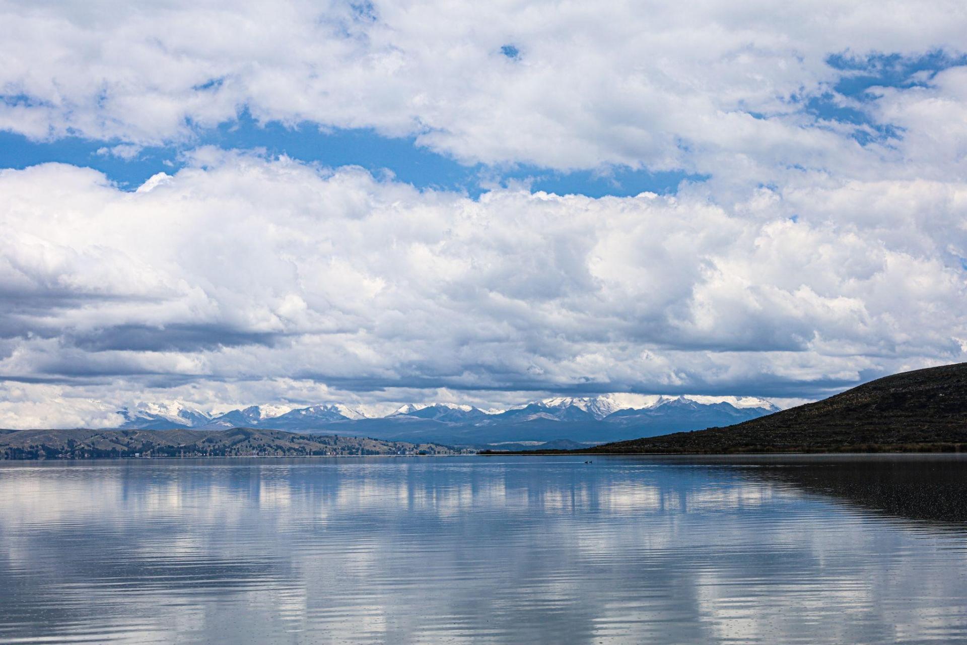
En la comunidad aymara de Quehuaya, Bolivia, ubicada a orillas del lago menor del Titicaca, también conocido como Wiñaymarka, nos espera Oscar Limachi, Indígena aymara dedicado al turismo y a la fabricación de artesanías con totora (una planta acuática, una especie de junco con el que se construyen balsas, artesanías, sombreros, techos de viviendas, etcétera). Con él vamos a recorrer parte del lago menor y culminar nuestra visita en Isla Pariti, un lugar que, según nos informa el mismo Oscar, tiene una de las mejores vistas del lago.
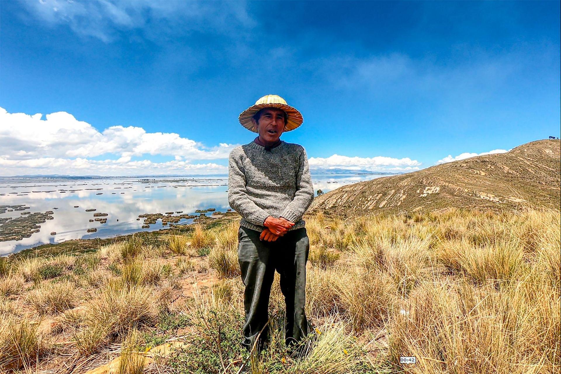
Oscar Limachi, artesano aymara y guía de turistas. Foto por Cultural Survival.
Mientras viajamos en la pequeña lancha de motor dirigida por Oscar, le preguntamos cuál es la profundidad del lago en esta región y cuánto ha disminuido a lo largo de los años. Él dice que en este este momento, febrero del 2024, esta zona del lago tiene una profundidad de alrededor de 50 centímetros (en algunas partes llega, incluso, a sólo 30 centímetros), mientras que entre 1974 y 1975, cuando Oscar tenía entre 12 y 13 años de edad, el lago tenía una profundidad de 2 metros; además, agrega que: “era muy cristalino, hasta tomábamos, no tenía olor, había buenos totorales, había buenas algas, peces de gran tamaño”.
Para estas comunidades (muchas de ellas aymaras), la disminución del nivel del lago ha implicado también la transformación de su modo de vida; antes eran comunidades dedicadas a la pesca y, en la actualidad, han tenido que buscar otras fuentes de ingresos económicos. Al respecto, Oscar comenta: “la población del lugar ya quedamos sin trabajo por pescado, antes vivíamos del pez, y ya ha rebajado el lago y los peces se pierden. Yo era pescador antes y por eso me dedico al turismo. ¿De qué vamos a vivir?”.
¿Por qué el nivel del lago Titicaca ha ido disminuyendo a través de los años? Para responder a esta pregunta recurrimos a varios expertos en el tema, entre ellos, Jorge Molina, investigador del Instituto de Hidráulica e Hidrología de la Universidad Mayor de San Andrés en Bolivia, una de las instituciones que, junto a otras universidades, dependencias y ministerios, recibieron, en julio del 2023, un informe del Servicio Nacional de Hidrografía Naval de Bolivia en el que se alertaba sobre una preocupante tendencia a la baja en el nivel del lago. Jorge Molina nos explica que “en el 2023 el lago alcanzó su nivel más bajo en más de 70 años, desde 1949” y aclara que ese nivel tan bajo no es resultado de un solo año, sino “es resultado de varios años, probablemente desde el 2002-2003, casi 20 años en que se verifica, se evidencia, una tendencia a esa disminución de niveles”.
¿Y qué ha ocurrido en estos 20 años para que el Titicaca se esté secando? Jorge Molina continúa explicando que “el nivel de un lago se mantiene por un balance entre las entradas y salidas de agua”. Las entradas “normalmente son la lluvia y el aporte de los ríos de su cuenca, y se compensan, en un balance hídrico, con las salidas”. En el caso del Titicaca, la principal salida de agua es la evaporación; Molina dice que “el 92% del agua que sale del lago es por evaporación y un 8% históricamente sale por el río Desaguadero, que es su principal efluente”.
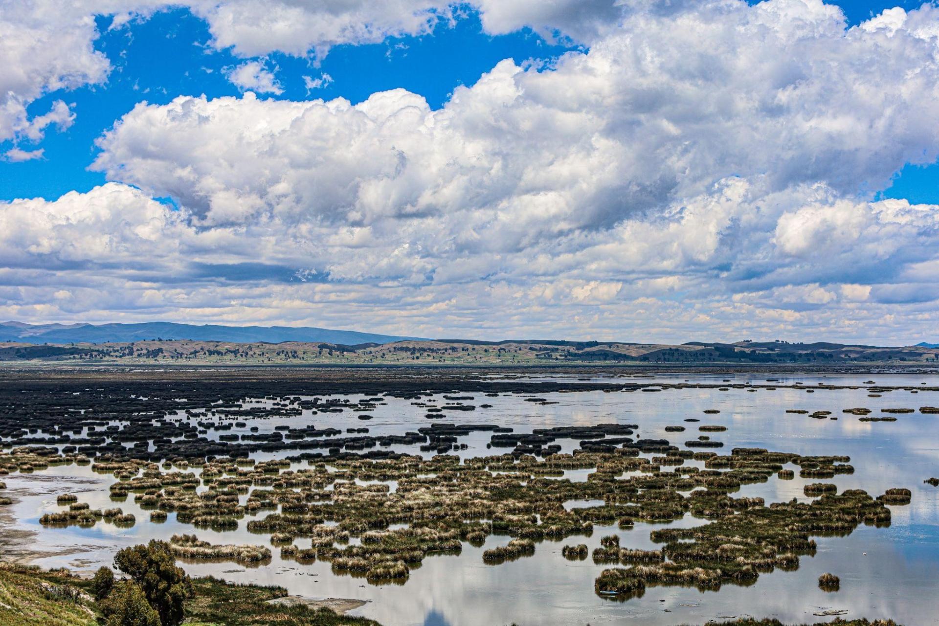
Lago Menor. Foto por Cultural Survival.
A largo plazo, continúa Jorge Mollina, “el balance de entradas y salidas de agua tendría que ser igual a cero, es decir, entradas son iguales a salidas”, sin embargo, “por periodos, en este caso un periodo de cerca de 20 años, el balance puede ser excedentario o deficitario”. Actualmente el lago Titicaca atraviesa un balance de agua deficitario, lo que “significa que las salidas han tendido a ser un poco más grandes que las entradas”, explica Jorge Molina, y eso es lo que ha causado el nivel tan bajo. Pero, ¿por qué durante al menos 20 años se ha mantenido una tendencia de menor entrada de agua al lago Titicaca? La respuesta es que se trata de factores múltiples, y entre los más importantes se encuentran: el cambio climático y la contaminación.
Al respecto, otro estudioso y apasionado del lago Titicaca, el investigador francés Xavier Lazzaro, comenta: “Como científico he tenido la chance de estudiar el lago menor del Titicaca en 1979-80, en una época que el lago era muy prístino, muy bien conservado como cualquier lago de la cordillera de los Andes, porque había poca población alrededor, no existía El Alto. Y he vuelto 30 años después y no podía creer lo que he visto: un lago impactado por toda la urbanización de El Alto, con ríos totalmente cloacales que desembocan en el lago menor”. Y es que la ciudad de El Alto —que colinda con La Paz y es la segunda ciudad más grande de Bolivia— ha tenido un acelerado crecimiento demográfico desde su fundación en 1985; además, es atravesada (junto a los municipios de Viacha y Laja) por varios ríos que arrastran todo tipo de desechos y contaminantes domésticos e industriales, y que desembocan en el lago menor del Titicaca.
Esta región (el lago menor) es, de acuerdo con Xavier Lazzaro, una de las menos profundas junto a la bahía de Puno, en Perú, lo que las convierte en “las dos áreas más sensibles a cualquier perturbación de naturaleza climática o humana”. Junto a Oscar Limachi, nuestro guía, comprobamos lo antes mencionado: en un recorrido por la Bahía de Cohana, ubicada a orillas del lago menor del Titicaca, constatamos, apenas bajando del automóvil en que nos transportamos, el grave nivel de contaminación: son hechos innegables el mal olor del río Katari, la coloración oscura de sus aguas y la gran cantidad de basura que arrastra. No obstante, a esta región siguen llegando aves que desde tiempos inmemoriales han habitado estos territorios; aquí, en la bahía de Cohana, nos encontramos con decenas de flamencos rosados. Esta región, que ahora es aprovechada por los habitantes de Cohana para el cultivo de forraje, era lago hasta hace pocos años. Oscar Limachi nos dice que el lago se ha ido retrayendo cada vez más, y nosotros nos sorprendemos porque mientras recorremos la zona (hoy transitable en auto) google maps indica que estamos avanzando sobre agua, es decir, para google maps aún hay lago en este lugar.
Vista de los totorales desde Isla Pariti, Bolivia. Foto por Cultural Survival.
El lago Titicaca es un ser ancestral. En “El libro del Observatorio Permanente del Lago Titicaca”, que amablemente nos compartió Xavier Lazzaro, se dice que “es uno de los 20 grandes lagos más antiguos”. Como se le conoce actualmente tiene 9 mil años, pero es el resultado de una sucesión de lagos antiquísimos, como el Mataro, que existió hace más de 2 millones de años. Durante todo este periodo, el Titicaca ha tenido grandes transformaciones de manera natural, pero en las últimas décadas los cambios se han acelerado. Cuando platicamos con Gonzalo Lora, ingeniero ambiental, experto en cambio climático y activista por el lago Titicaca, advierte que: “hoy en día el Titicaca está seriamente amenazado, porque fuera de las dinámicas naturales de desecación que están ocurriendo a lo largo de los millones de años, están las amenazas del cambio climático”. Además, el Titicaca “recibe más o menos los vertidos de 3 millones de personas, las alcantarillas de 3 millones de personas en Bolivia y en Perú”, a lo que se suma “el parque industrial de El Alto, Juliaca, Laja; la contaminación de la ganadería y la contaminación de la minería”.
El mayor reservorio de agua potable del Altiplano sudamericano y un lago emblemático para las grandes civilizaciones andinas, está en un grave riesgo, y junto a él están en riesgo las especies de flora y fauna (muchas de ellas endémicas) que lo habitan, así como están en riesgo las comunidades ribereñas que se sustentan económica, cultural y espiritualmente del lago. Gonzalo Lora enfatiza que: “Definitivamente el Titicaca va más allá de ser un paisaje bonito, de ser un lugar interesante, de ser el mayor cuerpo de agua del continente; el Titicaca es fundamental para sostener las dinámicas ecológicas del Altiplano y probablemente de gran parte del planeta. El lago Titicaca evapora más o menos en promedio 500 toneladas de agua por segundo, es mucha agua, es un servicio ecosistémico que no podríamos reemplazar de ninguna manera. Todo esto hace del Titicaca un corazón de agua”.
Con Oscar Limachi llegamos a Isla Pariti. Nos invita a bajar de la lancha, subir a un cerro y mirar el lago lleno de totorales: manchones cafés y verduzcos contrastan con el azul del lago. Aquí, en la punta de este cerro, el viento se siente con fuerza, enfría el rostro y las manos. En esta zona el Titicaca todavía es de un azul profundo. Lo miramos y nos convencemos de que, a pesar de padecer los embates del cambio climático y la contaminación, Mama Qota es un ser que resiste, que se regenera y que sigue dotando de vida a todo este territorio.
Escuche el radio documental: “Mama Qota Is at Risk” en tinyurl.com/mamaqota and watch at vimeo.com/ 937717476.
Foto superior. Flamencos rosados en la Bahía de Cohana, Bolivia. Foto por Cultural Survival.