In May, the Peruvian Prime Minister and Minister of Finance, Dr. Manuel Ulloa, presented a package of proposed projects to representatives of international commercial banks and multi- and bilateral lending institutions gathered in Paris. These projects, representing a total US $8 billion, will require at least US $4.6 billion from external sources. The largest investments are planned for projects to develop Peru's mining, petroleum, and hydroelectric potential. The second priority is the development of Peru's eastern lowlands. The Belaunde government plans to invest about US $850 million in roads, colonization, and rural development. This represents 72 percent of the total investments in the agricultural/rural development sector.
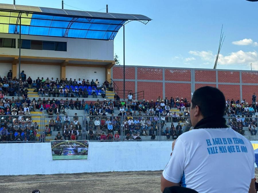
The target areas in the eastern lowlands are the Pichis-Palcazu (U.S. $235.1 million), Oxapampa (including Satipo, Tambo, and Ene; U.S. $110.7 million), Alto Mayo (U.S. $40 million), Jaen-Bagua-San Ignacio (U.S. $59.1 million), Alto Huallaga (U.S. $180 million), Huallaga Central (U.S. $164 million), and Forestry Development (U.S. $46 million). The government recently announced in Lima that the Madre de Dios and the Maranon-Ecuador border regions are targeted for similar development projects.
A Special Project Office (SPO) for each project will be established under the Prime Minister, purportedly permitting greater administrative autonomy. the USAID-supported Huallaga Central Project was the first to be administered in this way. An SPO was established for the Pichis-Palcazu Project in November 1980: others are expected to open soon.
Though the 1978 Native Communities Law guarantees each Indian settlement an adequate resource base, development plans for the Peruvian Amazon raise serious doubts about the government's intention to respect the rights of the region's 300,000 Indians. As many as 10,000 Aguaruna Indians will be affected by the Alto Mayo, Jaen-Bagua-San Ignacio, and border area project; as many as 20,000 Campa. Amuesha, and Cashibo Indians will be affected by the Pichis-Palcazu, and Oxapampa projects, and perhaps 4,000 Amarakaeri, Sapiteri, Huachipaeri, Ese'ejja, and Amahuaca will be affected by the Madre de Dios project.
To date, the Peruvian government has focused most of its attention on the Pichis-Palcazu Project, for which almost a quarter billion (U.S.$) will be invested in roads, colonization, and forestry development. Only USAID has made any firm financial commitment, about U.S. $6.5 million in AID and PL480 (Food for Peace) funds for preliminary studies, administrative costs, and initial road construction into the Palcazu. Thus far, the World Bank, the Interamerican Development Bank, and the Canadian government have expressed only interest.
To date, no clear development strategy or concrete project has emerged for the Pichis-Palcazu region USAID has only recently fielded an environmental impact team to evaluate the development potential of the Palcazu valley and to provide recommendations for a project design. The team will present its findings in early October. The proposed USAID contribution of U.S. $22 million to the Palcazu Project depends to a large degree on these findings.
Meanwhile, the Peruvian government has moved ahead to create a large SPO in Lima and two regional offices, one in the Palcazu and one in the Pachitea. Four more regional offices are planned for the near future. Construction is proceeding on the San Alejandro-Puerto Bermudez road, apparently financed with public funds. Construction on the 115 km branch road through the Palcazu valley, begun recently, is being financed with U.S. $4 million of PL480 funds. The Agrarian Reform Office has agreed to prepare a plan for land demarcation and settlement of an unknown member of columnists in the Pichis-Palcazu. The Forestry Department of the National Agrarian University will prepare a plan for forestry and lumber development for the same region.
Three key problems have surfaced concerning the Palcazu project. They are the classification of the land in the area, the construction of the road and its impact, and the determination of Indian lands and resources.
LAND USE POTENTIAL
A recent critique of the Pichis-Palcazu project (Amazonia Indigena, No. 3, April 1981) shows that in the past ten years six radically different sets of land classification figures have been made public by the Peruvian government, four of these within the past eight months. For the Palcazu, the total usable surface area has varied from as little as 50,000 hectares to as much as 190,000 hectares, depending, according to the author, on different political exigencies.
The most detailed land potential study was finished in 1980 by the government's own Office for Evaluating Natural Resources (ONERN). This study has not yet been made public. The resettles show that for the Palcazu valley, only 82.237 hectares are suitable for agricultural or forestry activities, a small decrease of 12,000 hectares from a less detailed ONERN study of 1970. The USAID land use experts evaluation team is even more skeptical; they question the land use potential given to various soils, suggesting that ONERN may have upgraded the entire soils suitability classification, and thus increased the land use potential for the Palcazu valley by as much as 35,000 hectares. In July of this year, a draft of the study was changed to upgrade 11,500 hectares of land from class C (for permanent cover crops) to class A (for annual crops). This represented a 400% increase in class A lands, from the previous estimate of 4500 hectares.
Critics argue that the Belaunde government, in its efforts to attract external funding, is manipulating the results of these studies to project an optimistic outlook for colonization and development in the valley. The present government could perhaps gain immediate political profits from having colonized a jungle region, but succeeding administrations would be faced with the social, economic, and environmental disasters which result.
PENETRATION ROAD
The 115 km branch road through the Palcazu valley will serve an additional 80 kilometers of feeder roads. According to a study completed in June, three criteria were used for selecting the final route: 1) skirting Indian communities in order to avoid colonist-Indian conflicts: 2) incorporating new lands suitable for agriculture and for colonization; and 3) maintaining distance from the Palcazu River to preserve it as a separate transportation route.
Yet the route proposed in June 1981 directly violates at least two of these criteria. It will bisect seven of the ten Indian communities located on the valley floor. According to ONERN land classification, the route will incorporate areas containing some of the poorest soils in the valley. In fact it will run through a fragile area which would encourage illicit lumbering and settlement. All agree this mountainous area must be protected from any development.
Finally, the proposed route crosses the headwaters of the major tributaries of the Palcazu River, necessitating a large number of bridges, and thus higher initial as well as long-term costs. For example, instead of one bridge across the Chuchurras River, the proposed route will require six bridges to cross the different affluents which from the Churchurras River. Current estimates for the road cost are about U.S. $400.000 per mile.
Nevertheless, the SPO has already begun construction of the first 18 kilometers of the Palcazu road. Officials expect this section, which will bisect four Indian communities (three of which have untitled lands) to be completed by the end of this year. Road building in the area, before implementing or even having a plan to control spontaneous settlement or lumbering will threaten the project's resource management goals and encourage a rapid and chaotic exploitation of the valley's limited resources, insuring a future fraught with social conflict.,/P>
INDIAN LANDS AND RESOURCES
In a recent meeting with Amuesha and Campa leaders, Nils Ericson, Peru's Minister of Agriculture, argued that Indian community structure was an impediment to Peru's Indian population which prevents them from benefiting from the national market economy. He indicated that the government would support initiatives to redistribute communally held land to individual Indian families. He informed the delegation that Indians living on untitled lands might be relocated in communities with titled land. Either action threatens the cohesiveness of Amuesha communities. His statements were met with an outcry from several local Indian organizations and from international support groups. In response, the SPO claimed that the "issue of politically opposed to the current regime." The report said that the SPO would take such actions as necessary to neutralize that opposition.
Partially in response to public outcry and to pressure from the U.S. Congress, USAID attached a land-titling condition to their funding commitment. Shortly thereafter, the SPO signed an agreement with the Office to settle the question of land tenancy for the present population of the Palcazu valley.
During a recent meeting of the Amuesha Congress, the SPO Director secured the voluntary cooperation of the Amuesha communities to clear a swath of forest along their boundary lines and circles with 30 yard diameters at each transect point. The technical staff will use these clearings to locate community boundaries on air photographs which are to be taken in November 1981. This will provide titled land, but a very limited amount to it.
Since 1976, all Amuesha communities in the valley have petitioned for title to additional land needed to create a continuous territory of about 60,000 hectares. Current titled holdings include less than 30,000 hectares for over 3,000 people. The most recent petition was presented to the Minister of Agriculture and to the SPO in February 1981.
In July, the SPO made it clear that the Indian communities would not receive more land despite the fact that there are contiguous, unsettled state-owned lands. State-owned lands are to be reserved for colonists. The Director justified this policy saying that Peru's tribal peoples must be incorporated into the market economy. Additional land grants to the Amuesha, he argued, would only encourage them to continue their primitive nomadism and subsistence agriculture.
Such arguments have little basis in reality. The Amuesha are currently the major food producers in the valley. They own and operate the largest rice mill. They own 20 percent of the cattle in the area. Recent studies, however, demonstrate shortages of land suitable for agriculture and commercial lumbering in most communities. Loma Linda, one of the largest communities, has less than 2 hectares of agricultural land per person. Government studies show that a family needs about 20 hectares to reasonably support itself in the area. Thus even with the current population it will be impossible to sustain commercial agriculture without quickly depleting the soils.
If the population continues to grow at the current rate (natural population growth plus immigration from communities outside the valley), it may double in as little as ten years. At that point the agricultural lands would be exhausted form overuse, and much of the forest, designated for protection, would be cleared for agriculture. Indians and poor colonists without adequate land will be obliged to work on the neighboring cattle ranches and in the lumber industry.
These are the real terms of incorporation of the Indians into the adequate land and resource base at this critical moment is to deny them the possibility of any autonomy over their economic development. To do that would deny them the possibility of any autonomy over their economic development. To do that would deny them any possibility of determining their participation in the market economy on an equal and competitive basis.
The USAID evaluation team will present its recommendations for the Palcazu valley by 15 October. They will emphasize conservation and careful management of scare resources. They will de-emphasize large-scale commercial agriculture and colonization. If USAID accepts recommendations, they must begin difficult negotiations with the Peruvian government, already committed to large-scale colonization. At stake is US $22 million in development funds for Belaunde and an open door to multinational mineral and petroleum investments. The stakes are high, but so is the risk of a social and ecological disaster in the Pichis-Palcazu.
Article copyright Cultural Survival, Inc.


