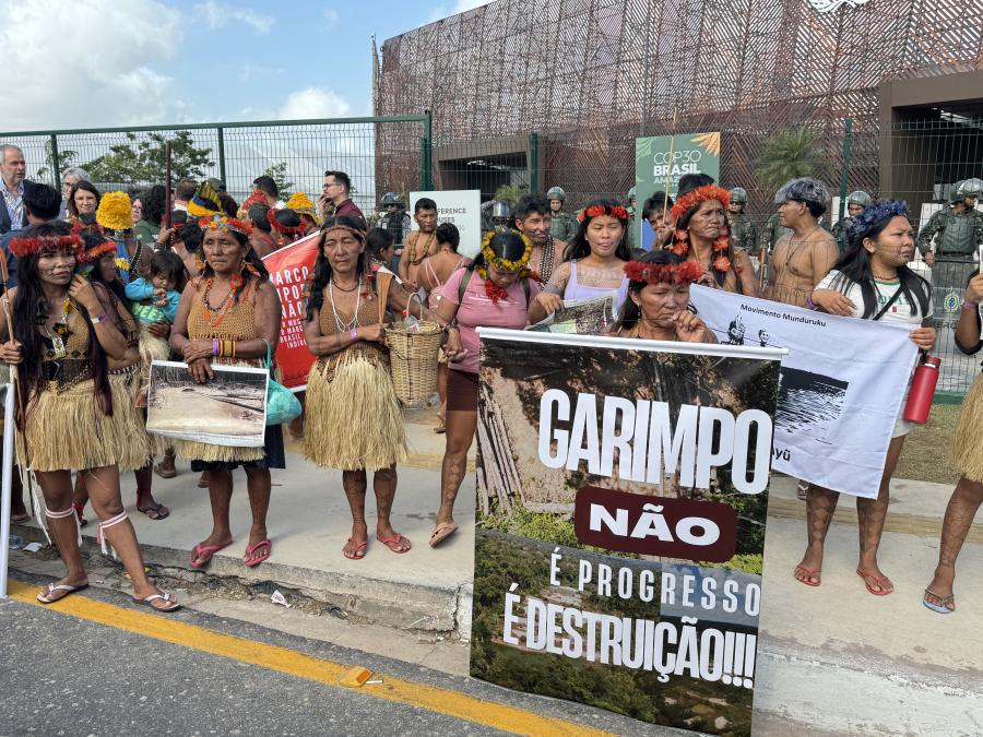
La estrecha relación de los Pueblos Indígenas con su medio ambiente ha dado lugar a sistemas de conocimientos únicos. Los mapas mentales de los ancianos se han utilizado durante generaciones para guiar la gestión de la tierra y la protección del territorio. Durante aproximadamente 12.000 años, este conocimiento permitió a los Pueblos Indígenas vivir en armonía en la densa selva amazónica, moldeándola y realzando su diversidad. A menudo, los hitos naturales y los territorios socioculturales funcionaban como fronteras tácitas sin fronteras definidas. Sin embargo, la dinámica que dio forma a los paisajes tradicionales de la ocupación territorial Indígena cambió con la incursión de extranjeros en los territorios Indígenas de Brasil. Como resultado de numerosos conflictos, la lucha Indígena se elevó al nivel federal. Luego de varios enfrentamientos, se estableció el artículo 231 de la Constitución brasileña para reconocer la demarcación física de las Tierras Indígenas como un derecho fundamental, salvaguardando su soberanía cultural e histórica.
A pesar de este logro legal, todavía queda un largo camino por recorrer antes de que estos derechos se ejerzan plenamente. Según la FUNAI, la agencia gubernamental de protección de los Pueblos Indígenas de Brasil, 153 territorios tradicionales aún se encuentran en la primera fase del proceso de demarcación, que puede tardar más de 20 años en completarse. Además, las tasas de deforestación dentro de las Tierras Indígenas han aumentado significativamente en los últimos años, siendo los territorios habitados por Pueblos en aislamiento voluntario los más afectados. Otros impactos continúan amenazando directamente el bienestar de estas comunidades, mientras que los desafíos relacionados con el clima empeoran las condiciones ambientales a nivel comunitario.
Si bien el Estado carece de recursos para implementar efectivamente los derechos territoriales Indígenas, las comunidades Indígenas, organizaciones y la sociedad civil han buscado soluciones complementarias. Internet se ha convertido en un poderoso recurso para defender los derechos Indígenas, difundir información y organizar y movilizar a las comunidades internamente. En este contexto, la ciencia Indígena se ha combinado con otros sistemas de conocimiento para garantizar la integridad de sus territorios y su bienestar. La integración de estos sistemas de conocimiento ha llevado a la creación de una tecnología social llamada sistema SOMAI-ACI, que incluye la plataforma del Sistema de Observación y Monitoreo de la Amazonía Indígena (SOMAI) y la aplicación de Alerta Climática Indígena (ACI).
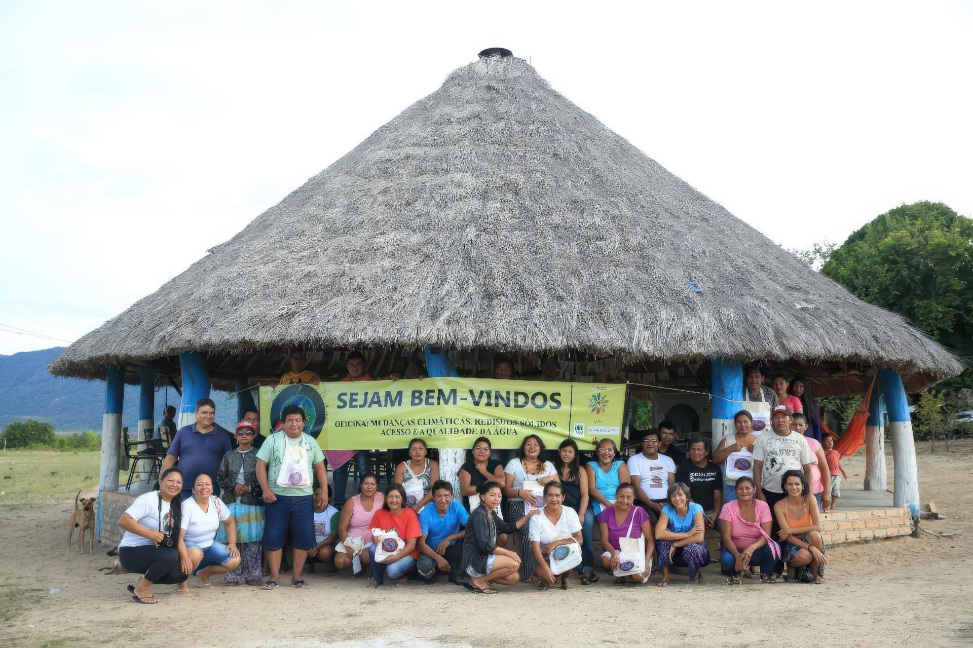
Taller realizado en Raposa Serra do Sol, IL, en Roraima, en colaboración con el CIR.
La vigilancia y el monitoreo territorial han sido durante mucho tiempo parte de las rutinas de las comunidades Indígenas. Estas estrategias a menudo combinan varios métodos, como el seguimiento por olor, el uso de puntos de referencia y la búsqueda de orientación espiritual. Sin embargo, en los últimos años, la escalada de los conflictos por la tierra ha exigido nuevos enfoques. En respuesta, el Instituto de Investigación Ambiental de la Amazonía, en colaboración con organizaciones Indígenas asociadas, desarrolló la plataforma geo-web SOMAI para apoyar las actividades de monitoreo. Alojada en una plataforma en línea de acceso abierto, SOMAI sirve como una biblioteca de datos, proporcionando información sobre los impactos que afectan a las tierras Indígenas en la Amazonía brasileña.
La plataforma SOMAI ofrece datos sobre territorios, uso de la tierra, proyectos de infraestructura y clima. Inicialmente diseñada para evaluar el nivel de exposición de cada territorio a impactos externos, la primera versión de SOMAI se lanzó en 2014 y fue mencionada en el Plan Nacional de Adaptación como una herramienta para apoyar los esfuerzos de adaptación climática. Entre sus principales socios se encuentran la FUNAI, la Articulación de los Pueblos Indígenas de Brasil (APIB), la Coordinadora de Organizaciones Indígenas de la Amazonía Brasileña (COIAB) y el Consejo Indígena de Roraima (CIR), entre otros.
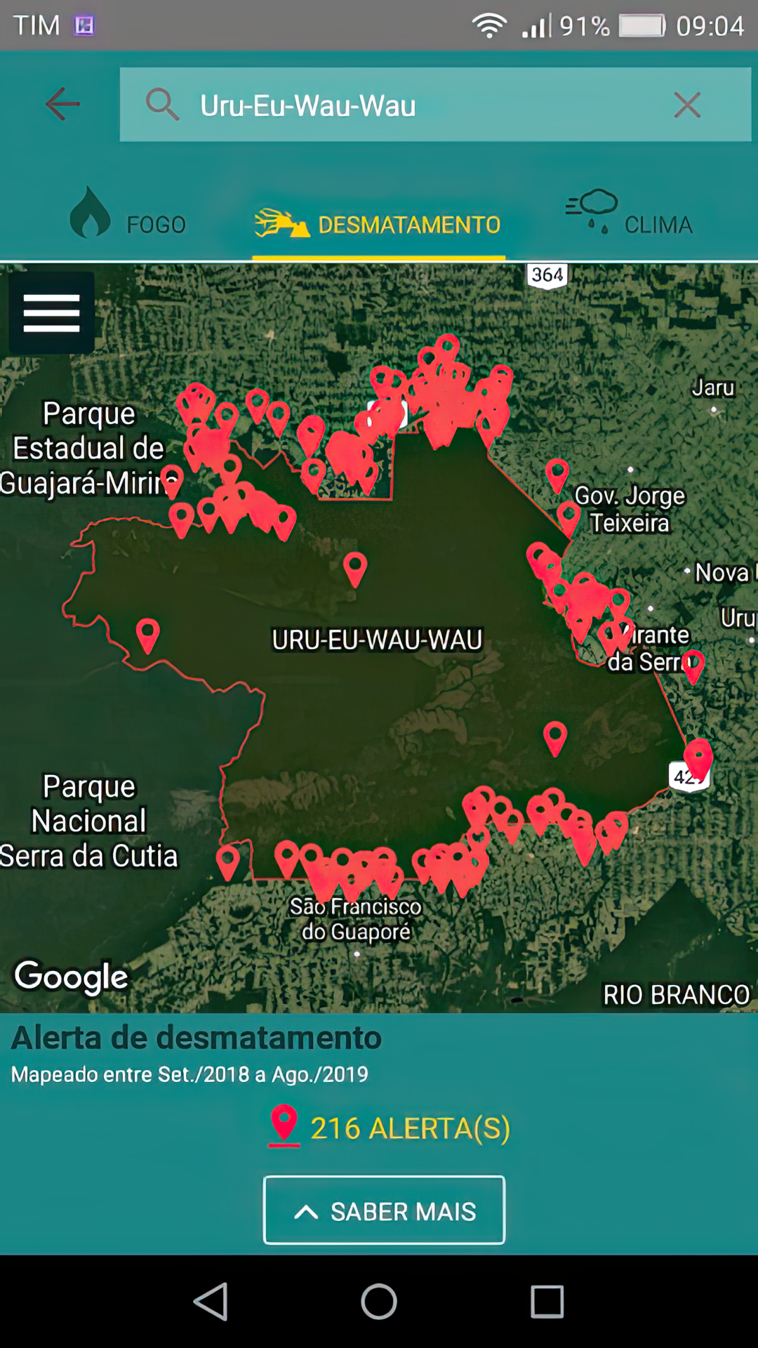
La versión 1.0 de la aplicación ACI genera alertas instantáneas de incendios, deforestación y datos meteorológicos para cada tierra Indígena en la Amazonía brasileña. Foto cortesía de IPAM.
La plataforma original divulgaba datos abiertos, en su mayoría provenientes de fuentes abiertas satelitales o públicas. A lo largo de los años, SOMAI ha ido evolucionando, incorporando nuevas funcionalidades en su tercera versión. Su dependencia de Internet llevó a la creación de la aplicación Alerta Climática Indígena en 2016, que, además de los datos satelitales, permite a los Pueblos Indígenas recopilar información directamente de sus aldeas, a menudo en áreas remotas con poco o ningún acceso a Internet.
A lo largo de su fase de desarrollo, el IPAM realizó varios talleres en los estados de Mato Grosso, Roraima y Maranhão. En este proceso, las organizaciones Indígenas colaboraron en el diseño del contenido y la funcionalidad que mejor se adaptara a sus necesidades. El diseño resultante de ACI genera alertas automáticas sobre incendios y deforestaciones en todas las Tierras Indígenas de la Amazonía brasileña, así como datos meteorológicos sobre temperaturas, lluvia y velocidad del viento.
Desde su primera versión, ACI se ha ido actualizando para incorporar nuevas funcionalidades de acuerdo a su uso por parte de los Pueblos Indígenas, principalmente agentes de monitoreo locales. Sirve como herramienta para mapear y localizar amenazas en el territorio, como la invasión territorial, la minería ilegal y la deforestación, lo que permite a las comunidades contar su historia de primera mano. La aplicación móvil cuenta actualmente con más de 900 usuarios en 32 organizaciones y está conectada a la plataforma SOMAI mediante inicio de sesión. Cuenta con un robusto sistema de seguridad que impide el acceso de terceros a la información privada recopilada de los 33 millones de hectáreas vigiladas por el sistema SOMAIACI, y ha demostrado ser una integración fructífera de la ciencia Indígena y no Indígena.
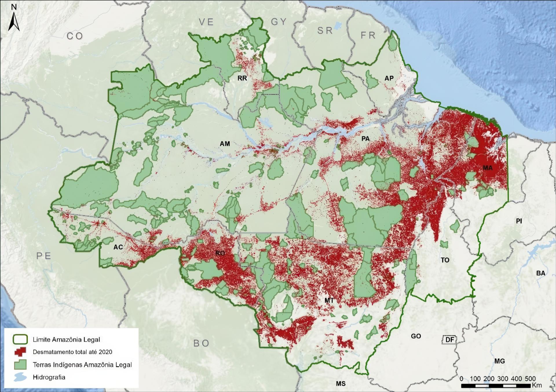
Las áreas rojas indican la deforestación total al 2020. Fuente: elaborado por IPAM, con base en datos INPE/PRODES, 2020.
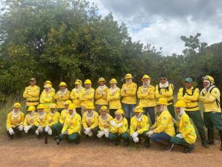
Brigadas de bomberos en el estado de Roraima
El Consejo Indígena de Roraima es una organización estatal ubicada en la región norte de Brasil, donde la Amazonía limita con Venezuela y Guyana. Si bien esta zona forma parte de la Amazonía, la vegetación nativa de la región comparte características con los ecosistemas de sabana. Trabajando en estrecha colaboración con nueve Pueblos Indígenas en 10 etno-regiones que representan alrededor de 50.000 personas, el CIR ha desarrollado un enfoque único que combina herramientas tecnológicas, como el sistema SOMAI-ACI, con el conocimiento tradicional sobre el terreno.
El fuego es un elemento natural gestionado por las comunidades Indígenas de la región, pero el cambio climático está alterando los patrones del clima e impactando las prácticas tradicionales de manejo del fuego. Para combatir y prevenir eventos de incendio dentro de las Áreas Protegidas como las Tierras Indígenas, un programa promovido por el gobierno federal apoya a los cuerpos de bomberos Indígenas, incluso en el estado de Roraima. CIR es un socio clave en esta alianza, liderando con un enfoque innovador. El impacto positivo de las brigadas Indígenas va más allá de la extinción de incendios y se extiende a la restauración de tierras, la educación ambiental y la gestión de tierras mediante la integración de datos satelitales con la ciencia ancestral.
La construcción, participación y recopilación de datos a través del sistema SOMAI-ACI ha demostrado que las tecnologías de la información y la comunicación pueden apoyar eficazmente la gestión de las tierras Indígenas. Sin embargo, aún persisten desafíos importantes para garantizar que estos proyectos beneficien a las comunidades Indígenas y al público en general. Si bien algunos de estos desafíos son tecnológicos, muchos de los problemas más apremiantes son sociales, políticos o económicos. Existe una necesidad urgente de establecer un canal de comunicación seguro que conecte el sistema SOMAI-ACI y las organizaciones que lo utilizan con las agencias federales de comando y control. Esta conexión es esencial para abordar los delitos y otras actividades ilegales que ocurren dentro de estas comunidades. Si bien la creación del Ministerio de los Pueblos Indígenas y la reestructuración de la FUNAI arrojan luz sobre un nuevo horizonte para superar estos desafíos y lograr avances sustanciales, aún queda mucho por recorrer.
Sineia Bezerra do Vale (Wapichana) es copresidenta para América Latina y el Caribe del Foro Internacional de los Pueblos Indígenas sobre el Cambio Climático.
Foto de portada: Brigadas de bomberos capacitadas por el CIR en alianza con la FUNAI y el IBAMA.